

Powerful storm to bring snow, rain, and strong winds to Newfoundland
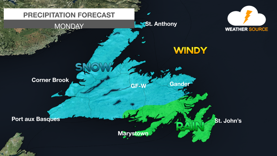
An area of low pressure will approach Newfoundland from the south on Sunday night.
Snow is expected across central and western Newfoundland. Precipitation will likely remain as rain in the eastern areas of the province.
Snowfall amounts across northeastern and central Newfoundland, parts of western Newfoundland, and the Northern Peninsula East could be significant, with 20 to 40 cm possible.
Based on the current track of the low, the Avalon Peninsula could see 20 to 40 mm of rain.
On Monday night, the low pulls offshore and sends wraparound snow back across Newfoundland, combined with high winds. Gusts may reach anywhere from 80 to 120 km/h.
Significant storm surge and wave activity is possible along the northeast coast of Newfoundland from Green Bay to Bonavista Bay Monday evening until Tuesday morning.
Conditions improve on Tuesday, and strong winds will persist.


Comments