

Weather bomb to slam into Newfoundland
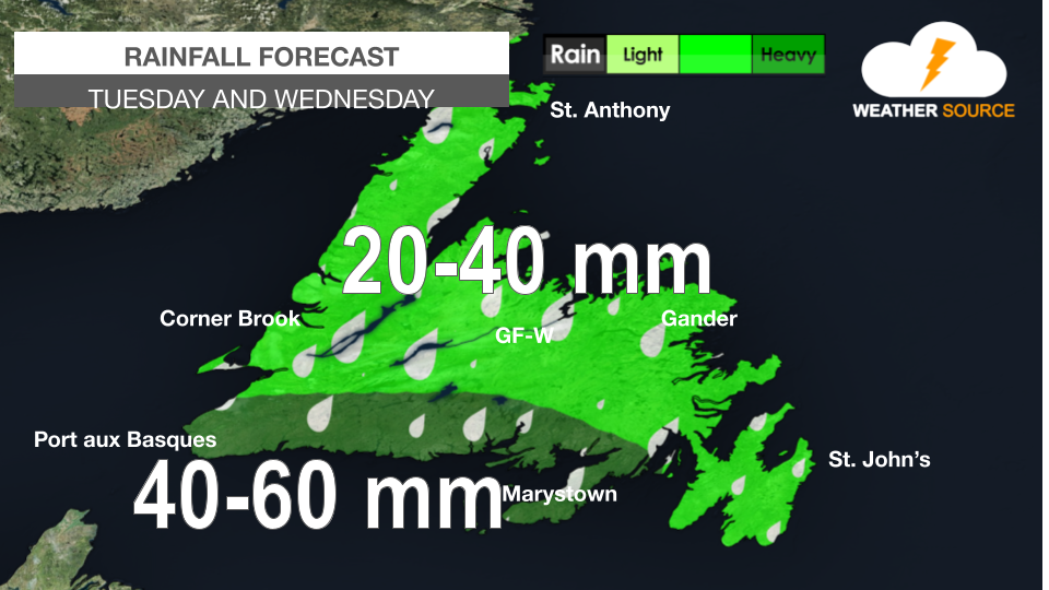
After a wet weekend, Newfoundland is about to get slammed by a weather bomb.
A 'weather bomb' is a low pressure system whose central pressure falls 24 millibars in 24 hours in a process known as explosive cyclogenesis.
On Tuesday, heavy rainfall and strong winds are expected over much of the island portion of the province.
The heaviest rainfall amounts are expected along the south coast where 30 to 60 mm are possible. The remainder of the Island will see about 20 to 40 mm of rain. For the western half of Newfoundland, rain may mix with of change to snow.
Strong winds are also expected. The winds will be the strongest over the Avalon Peninsula, where gusts up to 110 km/h are expected.
Due to the power of the low, coastal flooding is possible along the south coast of the Island near high tide on Tuesday between 4 and 8 p.m. Waves of 4 to 6 metres, breaking on approach to shore, are possible.
The low will impact Labrador beginning Tuesday night and lasting until potentially Friday night. It will bring significant rainfall up to 50 mm in 24 hours, and snow inland, significant wind up to 100 km/h and coastal flooding due to storm surge and large waves.


Comments